HillSpring Church provides hurricane relief in Lake Charles, Louisiana

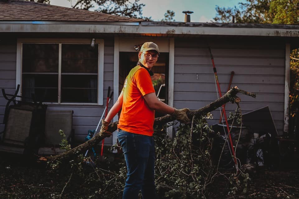
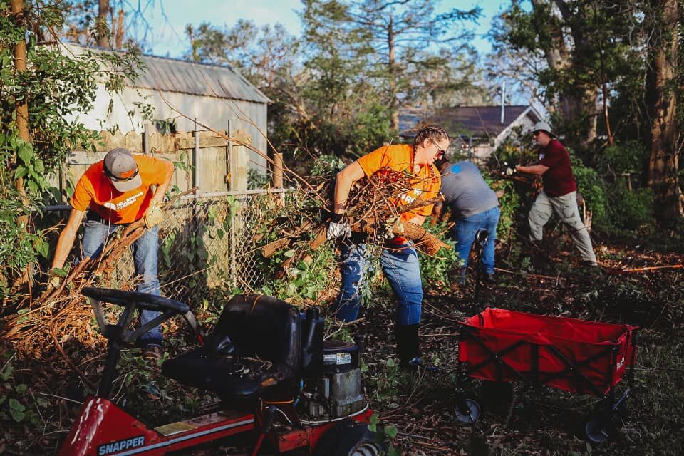
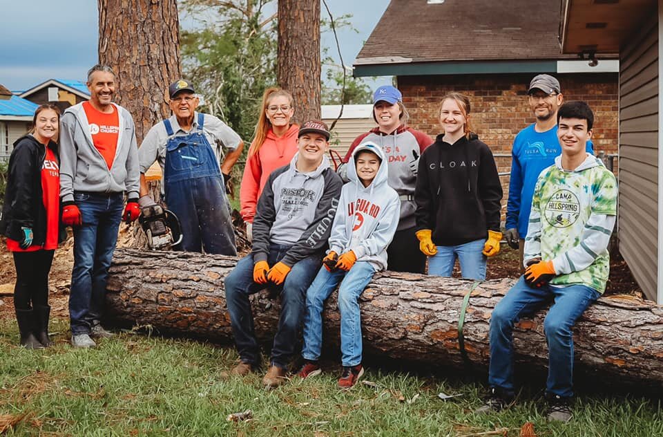
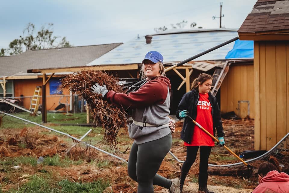
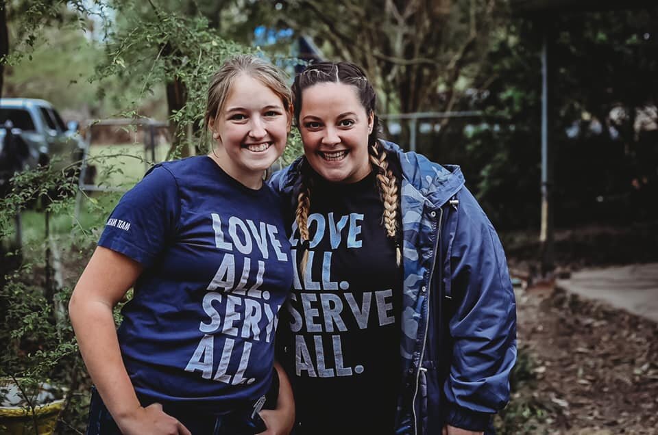
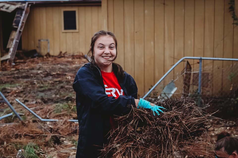
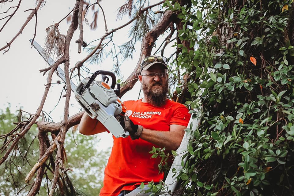
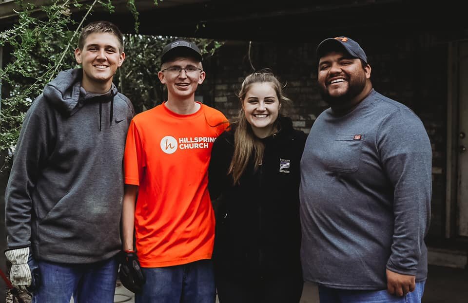
While most high school students were relaxing and hanging out with friends on Fall Break last week, students at HillSpring Youth Ministries were getting their hands dirty in Louisiana. HillSpring Church in Sand Springs sent a group of 26 on a relief mission to aid in cleaning up after Hurricanes Delta and Laura, and half were teenagers.

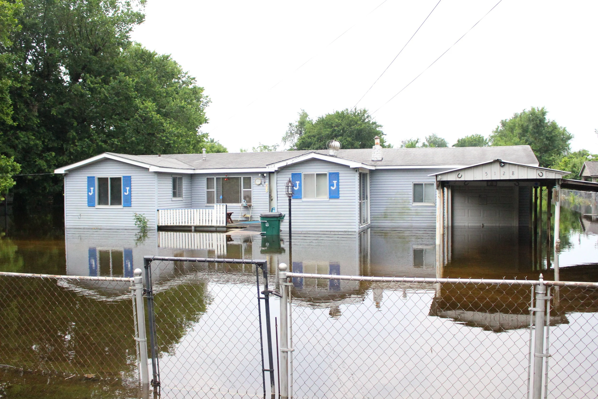
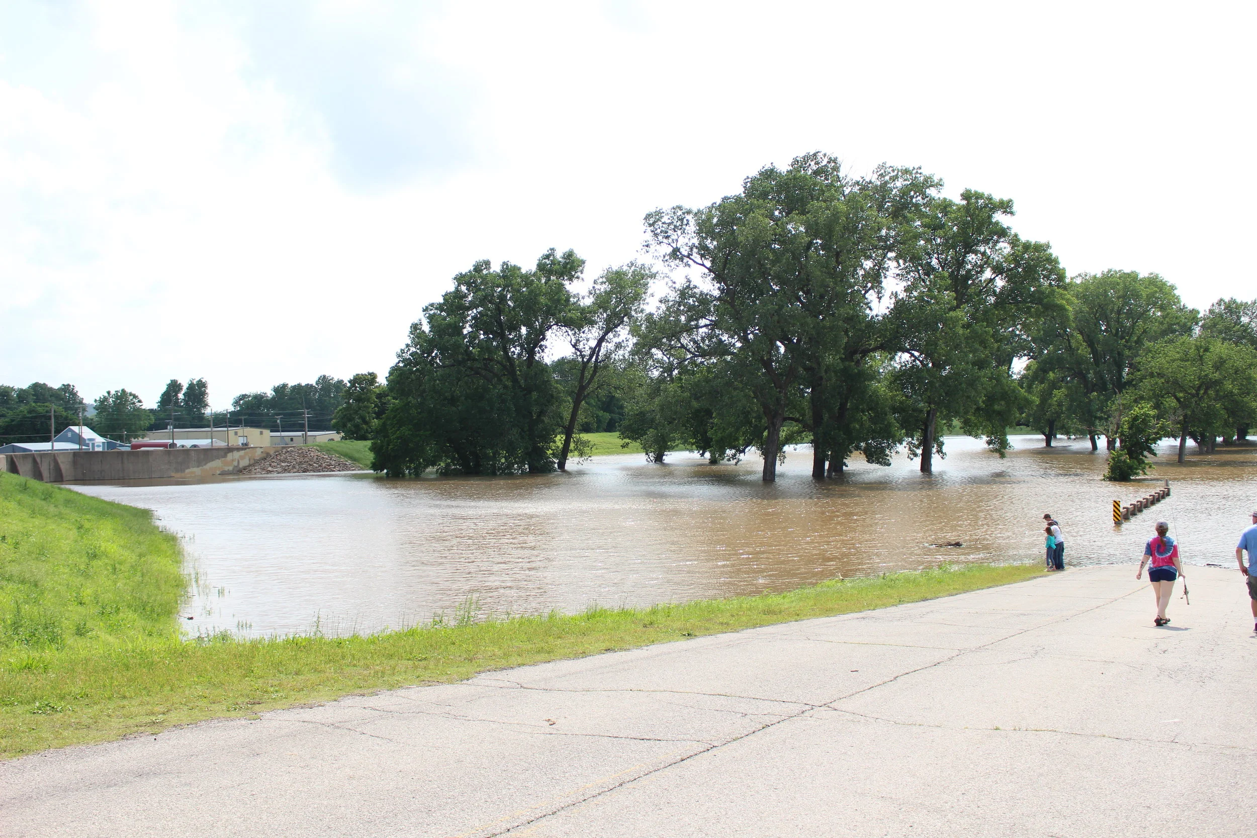
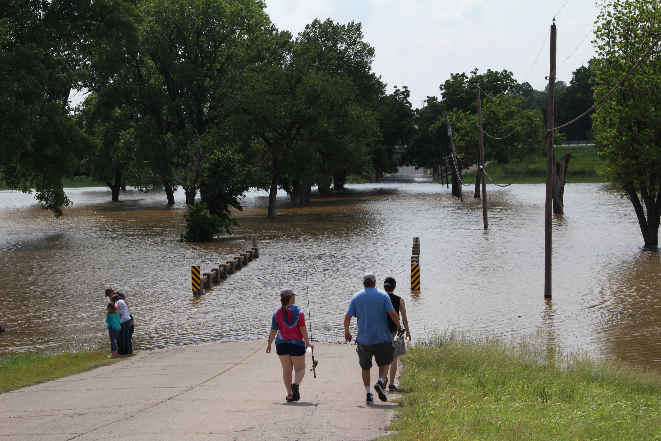
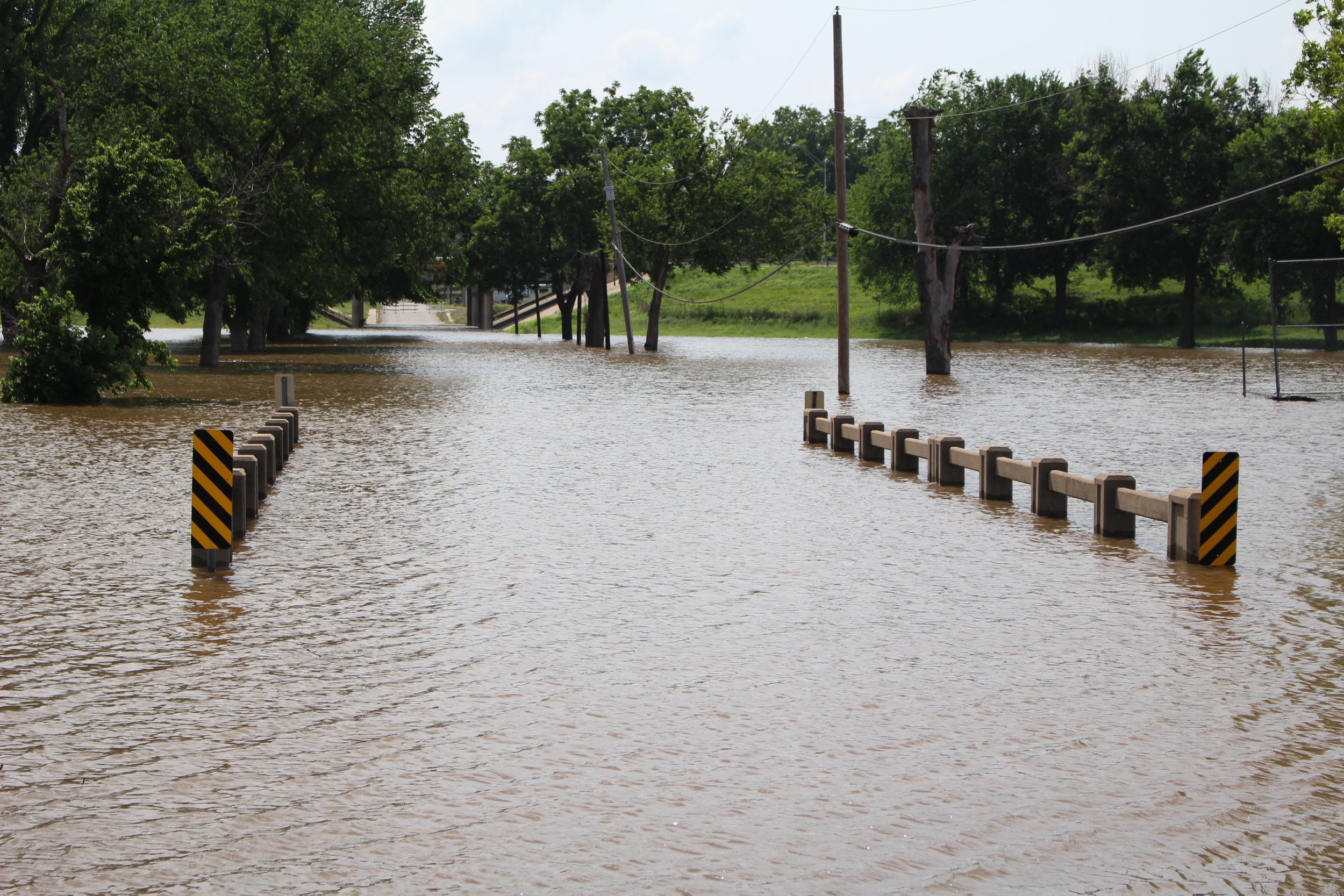
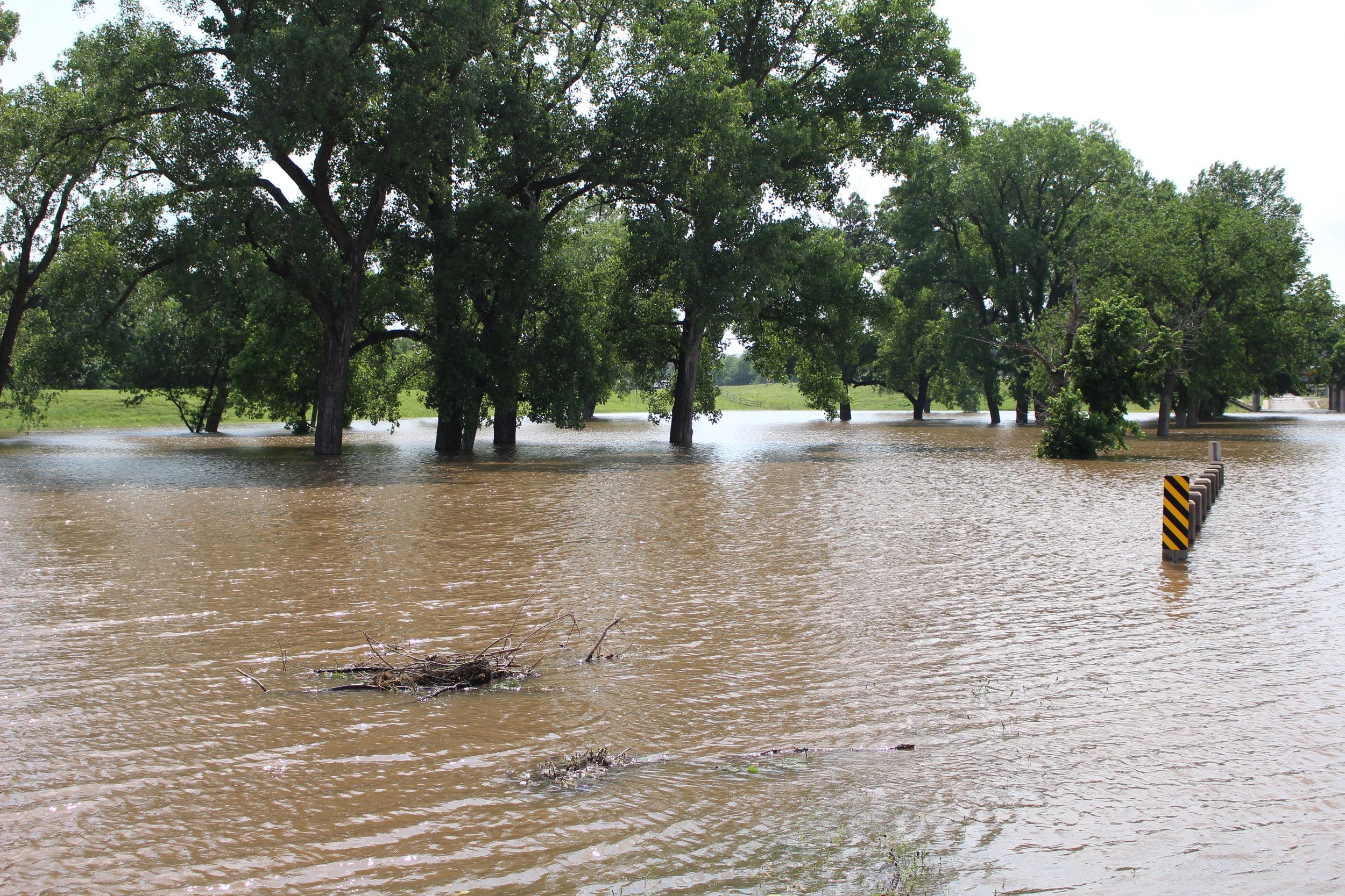
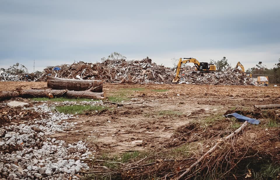
Hurricane Laura was the strongest hurricane to make landfall in Louisiana in over a century and was listed as a Category 4 when it hit on August 27. That storm caused an estimated $14 billion in damages, and was followed just six weeks later by the Category 2 Hurricane Delta, causing an additional $2 billion in damages.

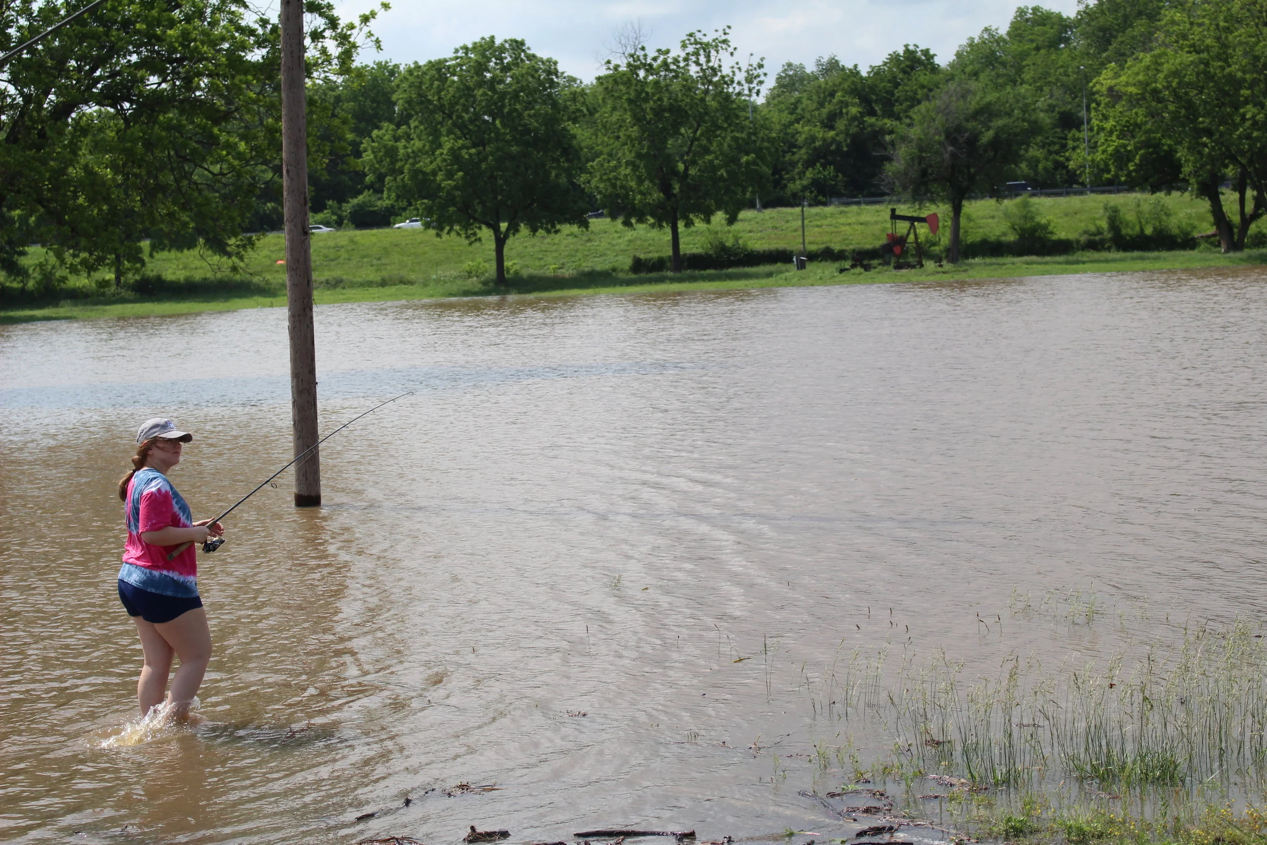
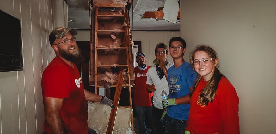
The HillSpring group partnered with Lakewood Bible Fellowship in Lake Charles to help with clearing debris, mucking out flooded houses, removing downed trees, mowing lawns, as well as offering prayer and support for families who were affected, said Executive Pastor Will Holder.

“I enjoyed getting to go meet all these different people,” said Jacob Dennis. “Their homes and surroundings are ruined, trees fallen everywhere. It was just good to go out and help them - bring a little light into their world in a dark time.”

Brooklyn Taber’s favorite part of the trip was the impact it made on the hurricane victims, and seeing them happy. “Their world just got ripped apart,” said Taber. “We made it just a little bit better.”

“For me personally, it was just something fun to get to go do,” said Dalton Wilcox. “The benefit of people’s smiles was incredible, and I always enjoy a good hard day’s work.”

“Our goal and our hope is that students would make a difference, not just in their neighborhood, but the world around them” said Associate Pastor Matt Barnett. “This was a week where we got to get them out of their element. 90% of them were new missionaries, first time on the mission field. They went out and really saw the world outside of themselves, saw the devastation, saw pain, saw hopelessness, and they got to bring just a little bit of hope to each of these families. What’s really cool is a lot of the kids got to talk with the people and pray with the people.”

HillSpring Church meets at 9:00 and 11:00 a.m. on Sunday mornings with Student Ministries every Wednesday at 7:00 p.m. The church is located at 8801 West 41st Street. For more information visit http://www.hillspring.tv/

Torrential downpours cause road collapse, business closure in Sand Springs

After weeks of little to no rain, Sand Springs got overloaded this past weekend. According to the Billie A. Hall Public Safety Center weather station in Sand Springs, the town received more than three inches of rain in a two-hour period Saturday night. The rapid downpour was enough to flood OkieSpice and Trade Co. at 107 North Main Street, causing the business’s indefinite closure. It also caused a section of 10th Street to collapse just west of 81st West Avenue.

One year later: remembering the great flood of 2019

Keystone Dam, May 14, 2019.

On May 14th, 2019 the Keystone Dam outflow surpassed 100,000 cubic feet per second for the first time since 1995. While the massive volume of water was enough to draw sightseers out to the dam and to make some folks nervous, it was only an inkling of what was to come.

By the 21st the City of Sand Springs closed Case Community Park and issued a voluntary evacuation advisory for the Meadow Valley subdivision due to flooding along Anderson Creek, an Arkansas River tributary. Dam outflow reached 161,000 cf/s.

Flooding inside Meadow Valley.

On the 22nd dam output reached 206,000 cf/s. The City of Sand Springs declared a State of Emergency, and Webco Industries evacuated the Star Center manufacturing plant on Highway 51. Natural Gas and Sanitary Sewer services were shut off inside of Meadow Valley and water began to overflow the riverbanks in the Riverside West and Town and Country subdivisions. The Sand Springs School District canceled final exams and ended the school year early. By the end of the night, the streets of Town and Country were almost completely submerged.

Flooding in Town and Country neighborhood.

At noon on the 23rd the dam outflow surpassed 250,000 cf/s and the Tulsa Boys Home was forced to evacuate. Highway 51 was shut down due to flooding.

Meanwhile, flooding began to affect the north side of the river as well. Bigheart Creek became a lake, completely flooding a large stretch of West 7th Street. The levee walls at the intersection of 65th West Avenue and Charles Page Boulevard began to leak, raising concerns about the structural integrity of the World War 2-era constructs.

West of town, the Candlestick Beach neighborhood began to flood, and Case Community Park is completely submerged. Sandite Pride received an exclusive tour of the flooded campus.

Exclusive look at the flooding inside of Case Community Park.

By the 27th, large areas of West Tulsa had been placed under voluntary evacuation. The National Guard had begun airlifting sandbags to at-risk areas, and placed an occupying presence along the levees. Checkpoints were established in flooded areas to prevent non-resident access.

As suddenly as it began, the flood ended. It lasted less than two weeks, and by June 2nd the dam outflow dipped below 100,000 cf/s, allowing the waters to recede in most areas. Then began the long recovery effort. Many former residents of the flooded areas have yet to return to their homes.

Click here to view Sandite Pride’s full photo and video gallery from the flood.

Ten Best Sand Springs Snowmen - Submitted by Readers

Sand Springs got a great little snow fall last week, and two days off of school gave our Sandites lots of time to work on some wonderful snowmen. Here are our ten favorite submissions:

Well-executed classic look with gloved hands and a little patriotism tossed in. Submitted by Rebecca Davis.

Creative tribute to one of Sand Springs’s best corporate citizens! Submitted by Wendy Susan Stanley McEntire.

Bonus points for nice clean snow and big ole eyes! Submitted by Cassie Hathaway.

Hard work makes Camden hungry. Photo submitted by Jill Nowlin Brewer.

Size isn’t everything, but if it was, this would be the winner. Huge snowman submitted by Megan Harris.

The straw hat snowman matches the house with a nice frontier look that perfectly represents Oklahoma. Submitted by Michelle Pearson.

Our only submission with a hat made of snow. Brilliant! Submitted by Angela Minney Turner.

Perfectly executed classic. Submitted by Jennifer Phillips Smith.

Pristine snow, well made, and the human lips sold it. Submitted by Erricka Stane.

A perfect Frosty, complete with a top-hat and pipe. Submitted by Ariel Casey.

Next time it snows, get creative and send in your photos to sanditepridenews@gmail.com or message us on social media!

Photo Gallery: Sand Springs Snow Day

Sand Springs to host free Storm Spotter Training Class

Nasty weather that endangers lives and damages properties can occur in Oklahoma at any time of the year. Understanding what is going on in the skies above can be a life or death proposition.

Trained citizen storm spotters play a critical role in providing life-saving information to local emergency managers and meteorologists at the National Weather Service office in Tulsa.

If you are interested in participating in a free storm spotter training class, please plan to attend this year’s event. Hosted by meteorologists from the Tulsa office of the National Weather Service, the class will take place at the community room of the Billie A. Hall Public Safety Center, 602 W. Morrow Rd. (south of Walmart) at the 7:00 p.m. on Wednesday, Feb. 26, 2020. No pre-registration is necessary.

The training benefits all citizens – from those affiliated with storm spotting organizations to those who just want a better understanding of what is happening around them when skies turn ominous. The class includes videos of severe storms, information on storm development and identification as well as statistics on severe storms and the damages they cause.

The training will help citizens discern between storms that have severe weather potential from those that only have menacing-looking clouds.

Although recent technology has greatly enhanced meteorologists’ abilities to provide critical and accurate storm information, trained storm spotters are irreplaceable for providing on-the-ground accounts of what is actually happening at specific locations. Many citizens have taken the class over the years to enhance their peace of mind, as well as possibly save the lives of others during a weather emergency.

For more information about the City of Sand Springs, please visit www.sandspringsok.org and follow the City’s social media on Face Book and Instagram for the latest updates.

Public Health Officials Encourage Personal Health Preparedness

One of hundreds of flooded homes in Sand Springs, Oklahoma during a historic flooding event in May of 2019.

September is National Preparedness Month and the Oklahoma State Department of Health (OSDH) joins state and national partners in encouraging year-round personal and community preparedness for disasters and disease outbreaks. Oklahoma’s recent storms are a reminder that severe weather can strike any time of year.

Personal health preparedness is about people having the ability to care for themselves and their family in the immediate hours and days following an emergency or disaster. Oklahomans have seen numerous severe weather events where power outages affected thousands of residents across the state.

Scott Sproat, director of the OSDH Emergency Preparedness and Response Service, said personal preparedness is vital to being able to recover from a disaster or public health emergency.

“It’s important for a household to be able to sustain itself for at least 72 hours,” said Sproat. “More resilient households make more resilient communities who are better able to recover after a disaster.”

In addition to basic supplies such as non-perishable and ready-to-eat food, water, first aid supplies, flashlights and batteries; families should ensure they have enough personal items such as prescription medication for several days and a cooler or chemical ice packs to keep certain medications cold during a power outage.

OSDH Emergency Manager Darrell Eberly said those with disabilities or special medical needs should plan ahead for accessible transportation needed for evacuation or to seek medical care.

“Those who use medical equipment requiring electricity should talk with a health care provider about how to prepare for its usage during a power outage,” said Eberly. “If you have a communication disability, make sure your emergency information explains the best way to communicate with you. Those who rely on dialysis should discuss with your dialysis provider how to access service if the regular site is inaccessible.”

In addition, families should have easy access to important documents such as insurance policies and proof of identification in an electronic format on a flash drive or secure cloud-based service.

For more information, preparedness information is available in English, Spanish and American Sign Language by visiting the OSDH YouTube channel and selecting the Preparedness playlist.

Sandite Football and Baseball teams to compete in weightlifting competition

The Charles Page High School Football and Baseball teams will be competing in the annual Sandite Lift-a-Thon Saturday, August 10th. The two teams will participate in an NFL-style combine from 8:00 a.m. to 12:00 p.m. and this year it’ll be open to the public.

The players have been busy collecting donation pledges, and on Saturday they’ll try to max out both their donations and their reps. They will be competing in bench press, squat, and clean lift.

The football team’s locker room will be open for tours, there will be food trucks, inflatables, and more. The junior high dance teams will be serving up breakfasts of either pancakes or biscuits and gravy.

The event was originally scheduled for August 3rd, but was postponed a week due to impending weather.

Sertoma and Pier 51 fireworks shows canceled due to flooding

The annual Pier 51 and Sand Springs Sertoma Club fireworks shows have been canceled for the 2019 season due to flooding.

The Sertoma Club has hosted an annual fireworks show on July 3rd since 1989, but this is the second time in the past three years that the event has been canceled. In 2017 the club had to cancel their show due to construction in Case Community Park. Now it has been called off due to extensive flood damage after the entirety of Case Park was submerged for more than a week.

Pier 51 on Keystone Lake also hosts an annual Independence Day fireworks show and has called off their festivities due to high waters and low revenue. At press time Keystone Lake is 25 feet higher than this date last year. According to event organizers, the area from which the fireworks are normally launched is currently submerged. High water levels and questionable lake conditions due to upstream flooding have put a damper on the Keystone-area economy this season.

One fireworks show that will continue unimpeded is the eighth annual Big Blast Fireworks Show and Kids Fun Fest at 17516 West 8th Street. Festivities kick off at 5:00 p.m. Saturday, June 22nd with the fireworks show beginning at dark. There will be free games, prizes, concessions and more with $10 kids passes available for unlimited inflatable jumps and a pony ride.

Sand Springs City Council issues continuance on controversial Dollar General location

Possible future site for a Dollar General store.

The Sand Springs City Council took no action on a controversial ordinance to rezone a vacant lot at 2702 North State Highway 97. More than fifty local citizens showed up in opposition to a proposed Dollar General location that they feel is inappropriately located in a residential area.

Council was schedule to vote on rezoning the land from residential to commercial to allow the construction of a Dollar General store by AAB Engineering. Because the Council meeting was moved forward a week from its previously scheduled date, Dollar General representatives were unable to be present for the meeting, and requested a continuance.

Because of the lack of representation from Dollar General, and because of the absence of Vice Mayor Patty Dixon, Council voted 5-1 in favor of delaying the rezoning vote until the July 22nd meeting.

In the rezoning application, AAB Engineering points to the close proximity of a gas station, water tower, mini storage facility, church, and radio station as justification for the commercial zoning. Additionally, a 1981 plat of the land indicated that business or commercial operations would be allowed on the lot.

However, the property sits at the intersection of Pond Drive, which is entirely residential. Approximately 238 local residents signed a petition in opposition of the rezoning, citing their desire for a quiet, rural community, and fear that the construction of a Dollar General would lead to additional future development in the area.

The City of Sand Springs voted to annex the Osage County land on May 20th. The Planning Commission voted 2-2 on the rezoning application at their last week’s meeting, failing to recommend either approval or denial of the request. However, the City staff has recommended approval.

Mayor Jim Spoon remarked that he was impressed with the public turnout for the meeting, and hoped to see as many citizens at the next meeting. One citizen remarked that they would be bringing even more opposition to the next meeting.

Police Chief Mike Carter gave a presentation regarding the 2019 Policing Plan and took public comment on the subject. This is the fourth year the department has adopted a policing plan and last year’s version was awarded the International Association of Chiefs of Police Leadership in Community Policing Award.

All officers will be issued new business cards with their name, badge number, and a website address to file online compliments or complaints. Following an unscientific Facebook poll with 93% community approval, the department will no longer restrict the hiring of officers with visible tattoos.

The department recently purchased six new police bicycles. They have been used successfully to silently close in on late night burglary suspects, to patrol trails systems and crowded community events, and to teach children how to ride bikes safely.

As part of the department’s Community Policing and Crime Reduction Plan officers took 51 students from Sand Springs Public Schools to a Tulsa ropes course to participate in the Community Trust Champions project.

The 2019 Policing Plan also calls for increased traffic violation warnings in lieu of fines, an improved system of acknowledging community complaints and disciplining officers, increased training and certifications, increased transparency, collaboration with local businesses for economic development, participation in the Hispanic Affairs Commission, Autism Awareness Training, and Critical Incident Inoculation Training.

In Other News:

Council revisited a request by Councilman Brian Jackson to have a Masonic Cornerstone installed at the new Billie A Hall Public Safety Center. The motion was previously defeated at both May Council meetings.

More than a dozen Masonic Lodge members turned out in support of the resolution, and former City Councilman Dean Nichols spoke on their behalf. The measure was approved by unanimous 6-0 vote.

Council unanimously approved the Worker’s Compensation Plan through the Oklahoma Municipal Assurance Group with a yearly premium of $489,706.

Council unanimously approved a resolution clarifying the City’s rules regarding retention of certain public records. The resolution allows for the immediate destruction of emails, social media posts, text messages, voicemails, and browsing history, leaving their retention up to the sole discretion of the individual employees involved.

Council unanimously approved an agreement with Crawford & Associates in the amount of $50,000 for accounting and consulting services.

Council unanimously approved an agreement with Arledge and Associates in the amount of $35,875 for for financial statement audit services.

Council unanimously approved a continuance regarding a rezoning request at the former K-Mart building. Council will vote July 22nd on whether to rezone 1200 East Charles Page Boulevard from Commercial Shopping to Commercial General.

Council unanimously approved a ratification of a Memorandum of Understanding for participation in the Southwest Area Tactical Team.

Council unanimously voted to declare as surplus two 2007 John Deere backhoes for trade-in.

Council unanimously voted to purchase a Yanmar Vio-80 Compact Excavator from DitchWitch of Tulsa for $102,550, and an Interstate 50TDL Equipment Trailer for $27,750.

Council unanimously approved a resolution setting forth guidelines to assist the City in pursuing legal claims and in responding to legal claims against the City.

Council unanimously approved a resolution affirming a Declaration of Emergency following the May 2019 Flood Event. The declaration authorizes and affirms the execution of contracts, budget amendments, waivers of competitive bidding, and payments to the pursuant contracts to restore City property and equipment that was damaged during the flood. City Staff is currently estimating a budgetary impact of $1,581,600 in flood damages.

Council unanimously approved a Master Service Agreement with Motorola Solutions for recurring services related to Motorola MCC 7500 dispatch consoles.

Council unanimously approved the appointment of the following individuals to various boards and committees:

  • Mike Burdge to Council Appointment Committee.

  • Christine Hamner to Council Appointment Committee.

  • Patty Dixon to Council Appointment Committee.

  • Mike Burdge to Council Finance and Development Committee.

  • Jim Spoon to Council Finance and Development Committee.

  • Patty Dixon to Council Finance and Development Committee.

  • Patty Dixon to Council Legislative Committee.

  • Christine Hamner to Council Legislative Committee.

  • Brian Jackson to Council Legislative Committee.

  • Jim Spoon to Council Public Works Advisory Committee.

  • Beau Wilson to Council Public Works Advisory Committee.

  • Phil Nollan to Council Public Works Advisory Committee.

  • Mike Burdge to the INCOG Board of Directors.

  • Jim Spoon as Alternate to the INCOG Board of Directors.

  • Jim Spoon to the INCOG General Assembly.

  • Elizabeth Gray as Alternate to the INCOG General Assembly.

  • Mike Burdge to the INCOG Legislative Consortium.

  • Jim Spoon as Alternate to the Legislative Consortium.

  • Derek Campbell to the INCOG - Tulsa Metropolitan Area Transportation Policy Committee.

  • TJ Davis as Alternate to the INCOG - Tulsa Metropolitan Area Transportation Policy Committee.

  • Phil Nollan to the Sand Springs Parks Advisory Board.

  • Daniel Comer to the Sand Springs Parks Advisory Board.

  • Harold Neal to the Sand Springs Planning Commission.

  • Keri Fothergill to the Sand Springs Planning Commission.

  • Phil Nollan to the Sand Springs Economic Development Authority.

  • Troy Zickefoose to the Tulsa County Criminal Justice Sales Tax Overview Committee.

  • Leia Anderson to the Pogue Airport Advisory Board.

  • Rick Westcott to the Pogue Airport Advisory Board.

  • Elizabeth Gray to the Sand Springs/Sapulpa Joint Board.

  • Derek Campbell to the Sand Springs/Sapulpa Joint Board.

In the Municipal Authority meeting following City Council, Trustees unanimously approved a $31,551 Agreement Renewal with the Metropolitan Environmental Trust for administering and operating the Sand Springs Recycling Project.

Trustees unanimously approved a one-year extension to a contract with Talley Golf, who operates the pro shop, grill, golf cart rental, and other services at the Canyons at Blackjack Ridge.

Flood damage cleanup day scheduled for Case Community Park

Sand Springs, OK - The Sand Springs Local Church Network and the City of Sand Springs is teaming up to create a special Case Community Park Cleanup event this Saturday, June 8, 2019.

The volunteer cleanup event is open to everyone and will be assisted by City of Sand Springs Parks staff. Volunteers should arrive before 8:00 a.m. Parking will be located at the south end of the Case Community Center parking lot (1050 W. Wekiwa Road, Sand Springs, OK). All volunteers will be asked to sign in, in order to help the community receive additional FEMA credit for their efforts.

Volunteers will split into several teams, covering much of the 120-acre park site, which was heavily damaged from the historical flood event this month. Workers are advised to wear work clothes, gloves, proper footwear, hat and sunscreen. The event is weather dependent.

All parties interested in helping out should monitor the City of Sand Springs Facebook page, which includes a “special event” posting on this gathering with real time updates including weather information.

Volunteers do not need to bring anything, however those who are able and willing to bring and operate small chain saws and gasoline powered backpack blowers are needed. Sweep brooms are also needed. Other tasks will include relocating metal bleachers washed away; picking up tree debris, operating pressure washers, sweeping and blowing off concrete walks, splash pads and more.

Senator Ikley-Freeman Statement on Tulsa Area Flooding

TULSA – Senator Allison Ikley-Freeman, D-Tulsa, released the following statement addressing the recent flooding in Tulsa:

“Today we received an update from the Army Corps of Engineers indicating releases from the Keystone Dam are falling and the level of the Arkansas River is dropping. While this is welcome news, it is important for residents to be aware the situation is still very serious, and health and safety risks remain. As floodwaters recede, neighborhoods will be inspected for safety before evacuated residents are able to return.

“The last few weeks have been very challenging for our communities, but our residents are tough and resilient. Please remember that nobody has to go through this alone; there are many resources available to help those affected by the flooding and severe weather. Residents can still dial 2-1-1 to request assistance. My constituents in District 37 can also call my office at (405) 521-5600 if you have questions or have a specific request for assistance. If you are able to volunteer with relief efforts, please contact the Red Cross at 1-800-733-2767 or visit their website at redcross.org.

“Over the coming weeks and months, I will work tirelessly to make sure our communities have the tools to begin the long road to recovery. I have been coordinating with officials at the federal, state, and local levels on relief efforts and will continue working with them through the recovery process. I want to thank Tulsa City Councilor Jeannie Cue, County Commissioner Karen Keith, and all of the officials who have put in countless hours assisting impacted communities. We also acknowledge and thank the Army Corps of Engineers, Oklahoma National Guard, and first responders for all they have done to protect us. We will continue to come together as Oklahomans and we will move forward.”

Residents Urged to Use Caution When Reentering Flooded Homes

As many residents prepare to return to their homes and property damaged by floodwaters, the Oklahoma State Department of Health (OSDH) encourages the public to use caution when reentering their home.

Scott Sproat, director of the OSDH Emergency Preparedness and Response Service, said there are a number of factors for residents to consider.

“In the upcoming weeks, there will be many Oklahomans returning to damaged homes,” said Sproat. “We want to ensure the public’s health and safety as we continue to recover from the recent disaster.”

If a flooded home has been closed up for several days, residents should assume there is mold and take proper precautions. Occupants should enter the home briefly to open doors and windows to let the house air out for at least 30 minutes before staying for any length of time. After standing water has been removed, use fans and dehumidifiers to help remove excess moisture. Fans should be placed at a window or door to blow the air outwards rather than inwards, so not to spread the mold.

It is recommended to have the home’s heating, ventilating, and air-conditioning (HVAC) system checked and cleaned by a maintenance or service professional who is experienced in mold cleanup before being turned on. If the HVAC system was flooded with water, turning on the mold-contaminated HVAC will spread mold throughout the house. Professional cleaning will kill the mold and prevent later mold growth. When the service determines that the system is clean and if it is safe to do so, turn it on and use it to help remove excess moisture from your home.

The following additional safety tips are recommended:

  • Ensure the utilities to a flooded building are shut off. Homeowners who are not familiar with electricity or their home’s electrical system should contact a professional to help make the property safe from electrical hazards.

  • Use flashlights. Avoid using lanterns, torches or matches to examine dark buildings. Flammable gases may be present and open flames can cause a fire or explosion.

  • Generators or other gasoline-powered machinery should only be used outdoors away from doors and windows as carbon monoxide exhaust can be fatal.

  • Contact your doctor if you’re concerned about medications having spoiled.

  • Throw away food that may have come in contact with flood or storm water as well as perishable foods which have not been refrigerated properly due to power outages. When in doubt, throw it out.

  • Be on the lookout for snakes or rodents which may be looking for shelter on higher ground.

For more information about safety after a disaster, visit www.cdc.gov or www.ready.gov.

Keystone Dam outflow reduced, community meeting scheduled and other resources for flood victims

For the first time in weeks, the U.S. Army Corps of Engineers has begun significantly scaling back release rates at the Keystone Dam. By 2:00 p.m. Thursday outflow had been reduced from 275,000 cubic feet per second to 230,000. Inflow is down to 204,251 cf/s, its lowest rate since May 20th. The flood pool is at 104.9% with pool elevation at 755.5 feet. With no additional rains, the Corps is projecting 100,000 cf/s by June 3rd.

By Monday evening the Sand Springs Police had shut down Highway 51 all the way from Riverview RV Park to 145th West Avenue due to flooding from Anderson Creek. The Arkansas River tributary was one of the first places to flood in Sand Springs, taking out the Meadow Valley subdivision, the Webco Star Center, Sand Springs Sand and Gravel Company, and Double H Sales.

National Guard checkpoints have been established at the Highway 51 intersections with 145th West Avenue, Town and Country Drive, and 165th West Avenue. Residents in those neighborhoods are still allowed to return, but the Meadow Valley subdivision was temporarily off limits.

At peak outflow, 145th flooded at the entrance to the neighborhood, cutting off access to anyone without a substantially lifted vehicle. However waters began to recede Wednesday evening. Some residents reported 2-3 feet reduction in water levels around their property.

Charles Page Boulevard closed Tuesday from 65th West Avenue to 74th West Avenue, then expanded to 81st on Wednesday. The National Guard is concerned about soil liquification under the roadway and potential sinkholes.

The Starbucks in River West shut down Monday and will remain closed until the Arkansas River flooding situation is resolved and the levee system is no longer at risk.

Case Community Park has been closed for the past week due to substantial flooding and will likely remain closed for some time.

Resources

Broadway Baptist Church will be hosting an informative event Thursday at 1000 North Adams Road for locals affected by the flood. Doors will open at 6:00 p.m. with remarks to begin at 6:30 p.m. Senator James Lankford, Congressman Kevin Hern, Governor Kevin Stitt, Insurance Commissioner Glen Mulready, Tulsa County Sheriff Vic Regalado, and Tulsa County Commissioner Karen Keith will be in attendance.

Senator Jim Inhofe will be on hand at 5:30 p.m. to speak with constituents, but will not be available during the 6:30 meeting due to a previously scheduled conference call. The event is only open to residents of Town & Country, Candlestick Beach, and other affected flood victims in unincorporated Tulsa County areas of Sand Springs. QuikTrip is providing free drinks and pastries for the event.

Angus Church at 4401 South 129th West Avenue is serving three meals a day for locals affected by the floods and tornadoes. Breakfast is at 8:00 a.m., lunch is at 12:00 p.m., and dinner is at 6:00 p.m. However, the Thursday dinner will be moved up to 5:00 p.m. so as to not conflict with the meeting at Broadway Baptist.

Broadway will be providing free dinner to flood victims, first responders, and military Sunday June 2nd from 5:00 p.m. to 7:00 p.m. The church is partnering with Rolling River Relief and Sand Springs Community Services to bring multiple food trucks. Broadway is also offering free clothing and some financial support. They can be reached at 918-245-7513.

The Churches of Christ Disaster Relief Inc. has opened a Disaster Relief Distribution Center at the Sand Springs Church of Christ Activity Building at 4301 South 113th West Avenue. Beginning Thursday, May 30th, they are open from 3:00 p.m. to 7:00 p.m. daily with boxed foods, baby care items, personal care items, cleaning supplies, and more. Flood victims should bring a valid driver’s license or ID card with your current address. This is a distribution site only and will not be able to receive donations.

Uhaul of Tulsa is offering free 30 day storage rental to anyone impacted by recent flooding. This is only at Uhaul Centers, not neighborhood dealers. Participating locations are 6105 South Peoria Avenue, 5140 South 103rd East Avenue, 3500 South Sheridan Road, 1006 South Memorial Drive, and 504 East Archer Street.

Samaritan’s Purse arrived Thursday to help with the physical labor that flood victims will have to deal with. The nondenominational evangelical Christian organization helps with gutting damaged homes to prep them for restoration. They are stationed in the Prattville Center at 3 West 41st Street to receive volunteers and flood victims in need of assistance. You can reach Samartian’s Purse at 918-257-1381. Samaritan’s Purse will provide training Monday through Saturday at 7:30 a.m. and on Sundays at 12:30 p.m.

Solace Church at 7314 West 41st Street will also be doing physical labor similar to Samaritan’s Purse. They can be reached at 217-853-1124.

Free meals are available for children up to age 18 from the Sand Springs Public Schools Child Nutrition Department. For information on locations and times, call 918-246-1430.

Sand Springs Community Services has food, clothing, cleaning supplies, hygiene products, toys, and other household items at 114 West 4th Street. They can be reached at 918-245-5183.

Sand Springs Care Closet at 3417 South 113th West Avenue has clothing and toys. They can be reached at 918-269-8434.

Harvest Church is receiving donations of cleaning supplies and canned goods at 1601 West 4th Street and can be reached at 918-245-0193. They have free cleaning supplies and bottled water at both their Sand Springs location and their 349 South 49th West Avenue location.

First Presbyterian Church at 222 North Adams Road has a food bank and can be reached at 918-245-1748.

Olivet Baptist Church at 155 North 65th West Avenue has a food bank and can be reached at 918-260-5369.

CrossPoint Church at 4600 South 129th West Avenue has a food bank and can be reached at 918-245-2534. They are accepting donations of bleach, gloves, cleaning supplies, bottled water, rags, and personal hygiene items.

HillSpring Church has clothing and licensed counselors available at 8801 West 41st Street and can be reached at 918-955-2031. They are accepting donations of trash bags, cleaning supplies ,bottled water, gloves, toilet paper, and paper towels.

Church That Matters has licensed counselors available at 3 West 41st Street and can be reached at 918-512-1486. They are accepting donations of bottled water, pre-packaged snacks, cleaning supplies, paper towels, gloves, and trash bags.

For resource updates, visit https://www.churchthatmatters.com/floodrelief

The City of Sand Springs canceled their “Chipper Days” event schedule for June 1st. The next date is July 13th. Citizens with a City water bill for proof of residence will be able to bring tree branches for free disposal.

Beginning Monday, free tetanus shots will be available at Gilstrap Chiropractic Clinic at 3900 South 113th West Avenue.

Keystone outflow will increase to 275,000 cf/s, flood waters will rise

Flooding in the Riverside West subdivision in South Sand Springs.

The U.S. Army Corps of Engineers (USACE) announced plans to increase outflow from the Keystone Dam Sunday after yet another torrential downpour soaked the state during an already historic wet-season.

Tornado sirens wailed across Green Country Saturday night and into Sunday morning as deadly twisters ravaged towns like Tulsa, Sapulpa, and El Reno. But what might ultimately end up causing even more property damage than the winds is the rain that came with it.

The Tulsa area received around an inch of rain, while areas upstream were doused in as much as three inches in the last 24 hours. Most of that water will find its way into the bursting banks of the Arkansas River, where Dam authorities are slowly inching their way closer to the record-setting 1986 outflow levels.

As of 5:00 p.m. Sunday, the lake is releasing 256,401 cubic feet per second, with inflow of 300,000. Waters are 33.04 feet above normal and the flood pool is 109.93% full. Though the USACE has yet to match the 1986 record of 305,000 cf/s, it has been releasing over 250,000 since Thursday, and over 200,000 since Wednesday. Even in the tragic flood of 1986, the outdated levee system never had to hold this much water for this long.

The conditions show no sign of improving. Outflow will increase to 265,00 cf/s Sunday at 7:00 p.m., and to 275,000 Monday at 7:00 a.m. With more showers in the forecast for six of the next eight days, it is imperative that people be aware of their surroundings. Those who live in flood plains should be prepared to evacuate on a moment’s notice. Additionally, many businesses, shopping centers, and other non-residential areas could be affected in the event of a levee failure.

Sand Springs would likely face flooding as far north as Highway 412 in the event of a levee collapse. Even if your home is outside the flood plain, you should make yourself aware of the City’s levee-failure emergency evacuation plan.

The City of Sand Springs has issued a warning for the few remaining citizens in the flooded Meadow Valley subdivision, saying they won’t be able to perform nighttime rescues in the subdivision. Neighborhood holdouts are advised that conditions are only going to get worse. The City of Tulsa is encouraging voluntary evacuation of homes along the levees.

If you are unsure of how flooding could impact your neighborhood, call emergency management at 211.

SEE RELATED: City of Sand Springs releases Levee-A Evacuation Plan, Tulsa encouraging voluntary evacuation

SEE RELATED: Leaking levees not a concern according to Tulsa County Levee Commissioner

Leaking levees not a concern according to Tulsa County Levee Commissioner

On Memorial Day weekend 1984 the area surrounding 65th West Avenue and Charles Page Boulevard was completely submerged in the worst flood Tulsa has ever seen. The water level from that event is painted onto the B Levee dike as a sobering reminder of the devastation that ultimately left 14 people dead in Tulsa.

Fast forward 35 years and once again Oklahoma is facing a statewide flood of historic nature. As of midnight Friday, the Keystone Dam is releasing 251,901 cubic feet of water per second. The dam has been releasing over 200,000 for 36 hours now, but during that time the lake rose two feet due to inflow exceeding 300,000. The flood control pool is at 104.92% capacity.

Not only is the ever-rising Arkansas River threatening the south side of Levee A, but a flooded Harlow Creek is steadily rising on the north side of Levee B. Page Boulevard runs right between the two, and the large concrete dikes on either side are springing leaks. The runoff from these leaks has drawn concern from local residents, but it’s of no concern to Levee officials.

According to Tulsa County Levee Commissioner Todd Kilpatrick, the leaks are perfectly normal. The dikes aren’t solid, they’re made of several concrete slabs joined together. Currently, the water is only coming out of the joints due to hydrostatic pressure. The same sight has been observed at the Keystone Dam.

Although he has spent years lobbying for increased funding and a new modernized levee system, he maintains that the current World War 2-era system is doing its job. The biggest danger to the sand-based levees isn’t the amount of water behind them, but the amount of time they’re inundated, allowing the earth to soak. and potentially liquefy.

Though the Tulsa/Sand Springs border is still safe for now, things are gradually worsening back to the west.

Case Community Park is completely flooded. Softball, soccer, and baseball fields are all submerged, as is the BMX track, the disc golf course, playgrounds, and the Rotary Super Splash Pad. As of 8:00 p.m. Thursday, water was nearly to the roof of the old soccer concession stands.

Sand Springs Parks Director Jeff Edwards says the Parks staff worked nonstop to remove as much at-risk park equipment as possible before the rising water finally brought their efforts to a stop. He believes they saved as much as $200,000 worth of picnic tables and other equipment.

The park received a $6 million remodel less than three years ago, but Edwards says the park facilities and equipment are insured. Between insurance and potential FEMA funding, finances shouldn’t be a problem for rebuilding most of the park. However, it’ll take extensive man-hours to clear debris and make repairs. All of the utilities will have to be inspected, the artificial turf in all of the playgrounds will have to be replaced, and its unclear how the waters will affect the BMX track’s berms.

On the bright side, all of the new playground equipment is expected to survive the waters without damage, as is the new amphitheater and the art pieces around the Great Lawn.

The Sand Springs Animal Shelter was evacuated Thursday afternoon as flood waters began approaching the building. The animals are being temporarily housed at the Humane Society of Tulsa. Animal Welfare workers will still be available to help with rescues.

Highway 51 is closed for the foreseeable future from Riverview RV Park west to 137th West Avenue. All four lanes are submerged due to overflow from Anderson Creek. Anderson Creek has also flooded the Meadow Valley subdivision all the way up to 26th Street, as well as the Sand Springs Sand and Gravel Company and Double H Sales.

The Tulsa Boys Home has evacuated all of their students. Privately placed boys have been picked up by their guardians, while wards of the State have been placed in temporary foster care.

The Riverside West and Town & Country subdivisions have flooded all the way up to 19th Street. At least seven blocks are under four feet of water or higher.

The White Water Recreation Area on the Southeast side of the dam has been completely flooded and closed off. Anyone wanting to view the dam will have to park on the north side of the river near Bush Creek Park.

As of 7:00 p.m. the beachfront at Candlestick Beach was flooded and beginning to cover parts of 14th Street. Voluntary evacuation is heavily encouraged for residents of the subdivision.

Oklahoma Highway Patrol has rescue boats staged at various points along the river. The Tulsa County Sheriffs Department is assisting with evacuation at Candlestick Beach and Town & Country, while the Sand Springs Police and Sand Springs/Sapulpa Joint Fire Department are occupying Highway 51 outside of Meadow Valley.

Click here to visit our Flood of 2019 homepage for extensive video and photo coverage.

Evacuations continue in Sand Springs as flood waters rise, Keystone output surpasses 205,000 cfs

Sand Springs, OK - The City of Sand Springs is advising Meadow Valley residents and others living in low lying areas along the Arkansas River to expect REAL flooding to occur and to take immediate action. The City is advising residents to take immediate actions to remove or protect property from those areas, and to consider a voluntary evacuation by 6:00 p.m. today. There is no mandatory evacuation in place.

With new information this morning from the USACE of dam releases increasing to 215,000 cfs later today and holding there, the City expects portions of the Meadow Valley neighborhood, and potentially others, to flood. This flood event is expected to last for several days. Highway 51 near 137th West Avenue will likely flood, making vehicular traffic there impossible.

Last night the City of Sand Springs declared an emergency disaster proclamation, with actions to take place designed to protect public health, reduce damage and render emergency services to citizens. Officials from Webco Industries have made changes to their operations at the former “STAR” center until this flood event has passed and are closed. Case Community Park remains closed with warnings for citizens not to enter. City Police and Fire crews are working the various scenes around the clock to monitor.

If an American Red Cross emergency shelter is needed later, plans are in place now for that to happen. The City reminds area residents to monitor the City of Sand Springs Face Book page for real time updates.

City of Sand Springs Advising Citizens for Flood Potential

Sand Springs, OK - The City of Sand Springs is advising area residents, especially those in the Meadow Valley housing neighborhood to brace for the potential of additional flooding. Although the rain event has stopped for now, the lag time for waters upstream of Keystone Dam to reach Sand Springs can delay flooding activities downstream for several hours.

Last night, City of Sand Springs Police and Fire teams reached out (via phone messages and neighborhood visits) to residents in the Meadow Valley neighborhood, along HWY 51 in Sand Springs to alert residents of the potential for flooding. This area, and others in Tulsa County which may not be in City limits but are near the Arkansas River, may be affected by the planned increases in outflows from Keystone Dam later tonight.

In Sand Springs City limits, Case Community Park has now closed until further notice. All sports and trail related activities are cancelled at this site. The Case Community Center (1050 W. Wekiwa Road) however remains open.

The City urges residents to pay attention to street closures and the accompanying traffic barricades that are placed to protect public safety.

This afternoon, the USACE confirms that 100,000 cubic feet/ second (cfs) of water is being currently, with 20,000 cfs increases planned at 2 p.m.; 4 p.m. and 6 p.m., leaving the discharge at that time to be around 160,000 cfs. The USACE will revise dam operations as needed after that.

Storm Spotter Training Class rescheduled for late February

Sand Springs, OK - A Storm Spotter Training Class originally scheduled for January 30th in Sand Springs has been postponed till February 27th due to the recent Federal Government Shutdown.

The class will be administered by meteorologists from the National Weather Service (NWS), which is a division of the National Oceanic and Atmospheric Administration in the U.S. Department of Commerce.

Weather changes constantly in Oklahoma – and sometimes not for the better. Understanding what is going on in the skies above can be a life or death proposition.

Sand Springs’ location on the western edge of the Tulsa metropolitan area places it on the front lines for severe weather events, which can potentially impact thousands of Oklahomans. Trained citizen storm spotters play a critical role in providing life-saving information to local emergency managers and meteorologists at the NWS office in Tulsa.

Area residents can receive storm spotter training from NWS meteorologists on Wednesday, February 27th, 2019, at 7:00 p.m. at the Case Community Center, 1050 W. Wekiwa Rd. There is no charge to attend, and pre-registration is not necessary. The training lasts about two hours.

The training benefits all citizens – from those affiliated with storm spotting organizations to those just wanting a better understanding of what is happening around them when skies turn dark. It includes videos of severe storms and information on how severe storms form and what they look like. The training will include statistics on severe storms and the damages they cause each time severe weather happens.

The training will help citizens better understand the different severe weather watches and warnings issued by NWS and help storm spotters analyze the differences between storms with real severe weather potential from those that only have menacing-looking clouds.

Although recent technology has greatly enhanced meteorologists’ abilities to provide critical and accurate storm information, trained storm spotters are irreplaceable for providing on-the-ground accounts of what is actually happening at specific locations. Many citizens have taken the class over the years to enhance their own piece of mind, as well as possibly save the lives of others during a weather emergency. 

Storm Spotter Training Class coming soon to Sand Springs

Sand Springs, OK - Weather changes constantly in Oklahoma – and sometimes not for the better. Understanding what is going on in the skies above can be a life or death proposition.

Sand Springs’ location on the western edge of the Tulsa metropolitan area places it on the front lines for severe weather events, which can potentially impact thousands of Oklahomans. Trained citizen storm spotters play a critical role in providing life-saving information to local emergency managers and meteorologists at the National Weather Service (NWS) office in Tulsa.

Area residents can receive storm spotter training from NWS meteorologists on Wednesday, January 30, 2019, at 7:00 p.m. at the Case Community Center, 1050 W. Wekiwa Rd. There is no charge to attend, and pre-registration is not necessary. The training lasts about two hours.

The training benefits all citizens – from those affiliated with storm spotting organizations to those just wanting a better understanding of what is happening around them when skies turn dark. It includes videos of severe storms and information on how severe storms form and what they look like. The training will include statistics on severe storms and the damages they cause each time severe weather happens.

The training will help citizens better understand the different severe weather watches and warnings issued by NWS and help storm spotters analyze the differences between storms with real severe weather potential from those that only have menacing-looking clouds.

Although recent technology has greatly enhanced meteorologists’ abilities to provide critical and accurate storm information, trained storm spotters are irreplaceable for providing on-the-ground accounts of what is actually happening at specific locations. Many citizens have taken the class over the years to enhance their own piece of mind, as well as possibly save the lives of others during a weather emergency.